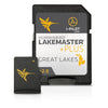
The Humminbird LakeMaster PLUS Great Lakes Edition, Version 2, micro map card with SD adapter has added over 140 lakes since the prior version - 50 in High Definition - and boasts more than 380 lake maps in High Definition and over 1,540 total lakes from MI, IN and OH.
The new PLUS series allows for aerial image overlay on high-definition waters giving you the ability to use quality aerial photography to view the entry and exits of creek channels, see how far a reef or weed line extends, and pick out shallow water rock piles, steep drop-offs or other features of the lake you’ve been missing from traditional maps.
New features – Updated shallow water area for Lake Michigan & parts of Superior; full coverage of Superior; all Lk Huron (incl Georgian Bay); Beaver Island on Michigan in HD; new HD survey of Lake St Clair (incl Canadian side); updated St. Clair River HD survey (incl Canadian side); updated Detroit River HD survey (incl Canadian side); HD survey of Syracuse, Kosciusko - IN; HD survey of Wamplers, Lenawee - MI; HD survey of Portage/Torch, Houghton - MI; HD survey of Lower Grand & Spring Lake - MI
LakeMaster SD/micro cards include features such as Depth Highlight, Shallow Water Highlight and Water Level Offset, which can be used exclusively with Humminbird fish finders
Can be used with Minn Kota i-Pilot Link allowing you to “Follow” a selected depth contour line, delivering precise, automatic boat control
Scrollable lake list allows you to view and research lakes from your Humminbird fish finder on and off the water
The Great Lakes product no longer includes Kentucky and Tennessee lakes. See the LakeMaster SouthEast Edition products for lakes in these states.
Opened packages are not eligible for return.
LakeMaster PLUS cards are compatible with all GPS-equipped APEX, HELIX, SOLIX, ONIX and ION Series models, along with select 600-1100 Series models.
The Great Lakes product no longer includes Kentucky and Tennessee lakes. See the LakeMaster PLUS SouthEast Edition products for lakes in these states.